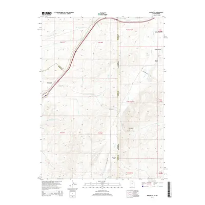
2014 Map of Wahsatch
USGS Topo · Published 2014About this map
Wahsatch sits at a critical high-elevation junction on the Utah-Wyoming border, where the interstate corridor follows the historic passage between the Wasatch and Uinta mountain ranges. This 2014 survey captures the high-country landscape surrounding Evanston as it transitions from the canyon systems of Summit County into the Wyoming basin. The terrain is defined by a dense network of seasonal drainages, including Shearing Corral Cr and Slaughterhouse Cr, which speak to the area’s long history of ranching and livestock movement. To the south, prominent geological formations like The Needles overlook Sage Creek Draw and Barker Reservoir, providing a detailed look at the water management and rugged topography of the Uinta County borderlands during the early 21st century.
Find a feature on this map
34 named features on this map. Tap any name to fly to it.
Don’t see what you’re looking for? This feature index may not catch every label — zoom into the map to look around manually.
Map Details
Editions of this 2014 Wahsatch Map
This is the sole edition of this map. No revisions or reprints were ever made.
Other maps of this area

1954 · Ogden
USGS Topo · 1:250,000

1958 · Ogden
USGS Topo · 1:250,000

1960 · Ogden
USGS Topo · 1:250,000

1965 · Evanston
USGS Topo · 1:24,000

1965 · Myers Reservoir
USGS Topo · 1:24,000

1965 · Millis
USGS Topo · 1:24,000

1968 · Wahsatch
USGS Topo · 1:24,000
1968 · Porcupine Ridge
USGS Topo · 1:24,000

1968 · Shearing Corral
USGS Topo · 1:24,000

1968 · Mc Kay Hollow
USGS Topo · 1:24,000