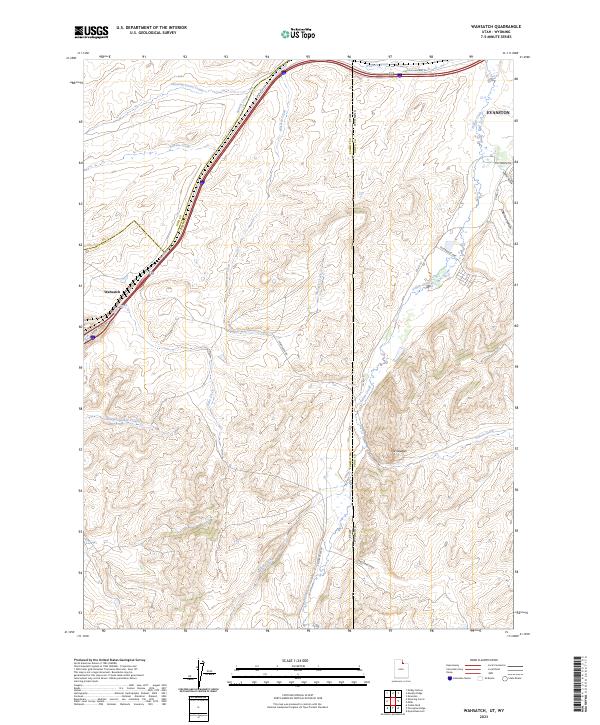
2023 Map of Wahsatch
USGS Topo · Published 2023About this map
Wahsatch sits at the head of Echo Canyon in Summit County, serving as a critical high-altitude junction near the Utah-Wyoming state line. This 2023 survey delineates the complex drainage patterns of the northern Wasatch Range, where Echo Creek flows southwest and Yellow Creek winds toward the outskirts of Evanston. The transportation history of the region is written into the landscape, with the historic route of Lincoln Highway 30 traversing the northern section. Notable landforms such as The Needles and numerous draws like Sage Creek Draw and Sulphur Hollow define the area's relief. Local infrastructure is represented by a network of rural routes including S Wahsatch Rd and Co Rd 151, which connect remote ranchlands and seasonal watersheds like Slaughterhouse Creek and Shearing Corral Creek.
Find a feature on this map
30 named features on this map. Tap any name to fly to it.
Don’t see what you’re looking for? This feature index may not catch every label — zoom into the map to look around manually.
Map Details
Editions of this 2023 Wahsatch Map
This is the sole edition of this map. No revisions or reprints were ever made.
Other maps of this area

1954 · Ogden
USGS Topo · 1:250,000

1958 · Ogden
USGS Topo · 1:250,000

1960 · Ogden
USGS Topo · 1:250,000

1965 · Evanston
USGS Topo · 1:24,000

1965 · Myers Reservoir
USGS Topo · 1:24,000

1965 · Millis
USGS Topo · 1:24,000

1968 · Wahsatch
USGS Topo · 1:24,000
1968 · Porcupine Ridge
USGS Topo · 1:24,000

1968 · Shearing Corral
USGS Topo · 1:24,000

1968 · Mc Kay Hollow
USGS Topo · 1:24,000