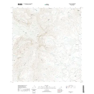
2017 Map of Waialeale
USGS Topo · Published 2017About this map
Wai'ale'ale and the peak of Kawaikini dominate this landscape, which serves as the hydrographic heart of Kaua'i. The intricate drainage patterns shown here illustrate how water moves from these high summits down through the Wainiha Valley and Lumaha'i Valley via the Wainiha River and Lumaha'i River. To the west, the map details the dramatic drop into Olokele Canyon, while the eastern slopes feed the N. Fork Wailua River and its numerous tributaries.
Find a feature on this map
70 named features on this map. Tap any name to fly to it.
Don’t see what you’re looking for? This feature index may not catch every label — zoom into the map to look around manually.
Map Details
Editions of this 2017 Waialeale Map
This is the sole edition of this map. No revisions or reprints were ever made.
Other maps of this area

1954 · Kauai
USGS Topo · 1:250,000

1963 · Anahola
USGS Topo · 1:24,000

1963 · Lihue
USGS Topo · 1:24,000

1963 · Hanapepe
USGS Topo · 1:24,000

1963 · Kapaa
USGS Topo · 1:24,000

1963 · Koloa
USGS Topo · 1:24,000

1963 · Hanalei
USGS Topo · 1:24,000

1965 · Waimea Canyon
USGS Topo · 1:24,000

1965 · Haena
USGS Topo · 1:24,000

1965 · Waialeale
USGS Topo · 1:24,000