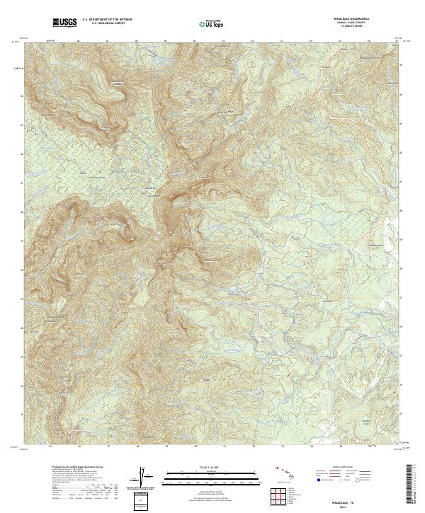
2024 Map of Waialeale
USGS Topo · Published 2024About this map
Wai'ale'ale stands as the dramatic centerpiece of this interior Kauai landscape, where extreme rainfall feeds a complex network of diverging watercourses. The drainage patterns define the territory, with the Hanalei River and Wainiha River carving deep valleys through the northern ridges while the North Fork Wailua River and South Fork Wailua River extend toward the east. The high-altitude saturation of the Alaka'i Swamp contrasts with the volcanic geology of Kilohana Crater to the southeast.
Find a feature on this map
74 named features on this map. Tap any name to fly to it.
Don’t see what you’re looking for? This feature index may not catch every label — zoom into the map to look around manually.
Map Details
Editions of this 2024 Waialeale Map
This is the sole edition of this map. No revisions or reprints were ever made.
Other maps of this area

1954 · Kauai
USGS Topo · 1:250,000

1963 · Anahola
USGS Topo · 1:24,000

1963 · Lihue
USGS Topo · 1:24,000

1963 · Hanapepe
USGS Topo · 1:24,000

1963 · Kapaa
USGS Topo · 1:24,000

1963 · Koloa
USGS Topo · 1:24,000

1963 · Hanalei
USGS Topo · 1:24,000

1965 · Waimea Canyon
USGS Topo · 1:24,000

1965 · Haena
USGS Topo · 1:24,000

1965 · Waialeale
USGS Topo · 1:24,000