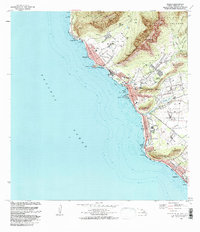
1983 Map of Waianae
USGS Topo · Published 1983About this map
Kaneaki Heiau and Kamaile Heiau stand as significant cultural landmarks along the leeward coast of Oahu in this early 1980s survey. The landscape is defined by the sharp transition from the steep ridges of the Waianae Kai Forest Reserve down to the coastal settlements of Makaha and Waianae. The map documents a complex mix of land uses, including the expansive Waianae Homesteads and significant military footprints like the US Naval Transmitting Facility. Along the shoreline, numerous public spaces such as Pokai Bay Beach Park and Maili Beach Park emphasize the importance of the coast for recreation. Significant topographical features like Puu Paheehee and Puu Mailiili rise abruptly from the plains, while the residential grids of Maili and Nanakuli follow the path of Farrington Hwy.
Find a feature on this map
62 named features on this map. Tap any name to fly to it.
Don’t see what you’re looking for? This feature index may not catch every label — zoom into the map to look around manually.
Map Details
Editions of this 1983 Waianae Map
2 editions found
Other maps of this area

1953 · Haleiwa
USGS Topo · 1:24,000

1953 · Schofield Barracks
USGS Topo · 1:24,000

1953 · Ewa
USGS Topo · 1:24,000

1954 · Oahu
USGS Topo · 1:250,000

1954 · Waianae
USGS Topo · 1:24,000

1954 · Kaena
USGS Topo · 1:24,000

1960 · Haleiwa
USGS Topo · 1:24,000

1960 · Schofield Barracks
USGS Topo · 1:24,000

1961 · Oahu
USGS Topo · 1:250,000
1962 · Ewa
USGS Topo · 1:24,000