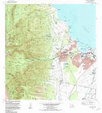
1983 Map of Wailuku
USGS Topo · Published 1984About this map
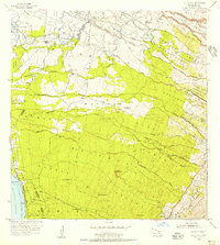
Wailuku and Kahului serve as the commercial and civic heart of Maui in this early 1980s record. The map details a landscape where ancient Hawaiian cultural sites, such as Haleiki Heiau and Pihana Heiau, exist alongside mid-century institutions like Maui Memorial Hospital and the Maui Community College. The transition from the steep, ridged interior of the West Maui Forest Reserve to the developed coastal plains is sharp, marked by the deep incision of the Iao Stream and the Iao Valley State Park. Settlement patterns reflect both historical and modern Maui, from the Kahakuloa Homesteads to industrial zones near Kahului Harbor and the residential clusters of Puohala Village and McGerrow Village. Notable historical landmarks include the Battle of Kepaniwai Historical Marker, grounding the map in the island's martial history, while the proximity of Baldwin High School and the Maui Community Correctional Center shows the functional layout of the county seat.
Find a feature on this map
91 named features on this map. Tap any name to fly to it.
Don’t see what you’re looking for? This feature index may not catch every label — zoom into the map to look around manually.
Map Details
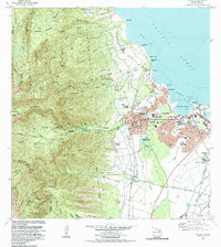
Editions of this 1983 Wailuku Map
2 editions found
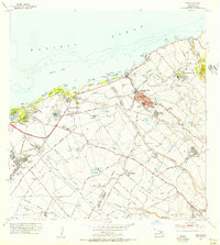
Other maps of this area

1954 · Maui
USGS Topo · 1:250,000
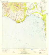
1954 · Maalaea
USGS Topo · 1:24,000
1954 · Paia
USGS Topo · 1:24,000
1954 · Puu O Kali
USGS Topo · 1:24,000
1955 · Olowalu
USGS Topo · 1:24,000

1955 · Wailuku
USGS Topo · 1:24,000

1955 · Kahakuloa
USGS Topo · 1:24,000
1956 · Lahaina
USGS Topo · 1:24,000

1956 · Honolua
USGS Topo · 1:24,000

1966 · Maui
USGS Topo · 1:250,000