1983 Map of Wailuku
USGS Topo · Published 1985About this map
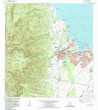
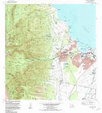
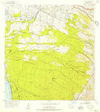
The urban core of Central Maui unfolds across this 1983 revision, showcasing the commercial and residential expansion between Wailuku and Kahului. The coastal landscape is anchored by the deep-water Kahului Harbor and the recreational stretches of Waiehu Beach Park and Waihee Beach Park. Moving inland, the terrain rises sharply into the West Maui Forest Reserve, where the iconic pinnacle of The Needle marks the entrance to Iao Valley. Historical sites are well-documented, from the ancient Halekii-Pihana Heiau State Monument to the Battle of Kepaniwai Historical Marker. The region’s economic transition is visible in the proximity of a Sugar Mill near Puunene to emerging institutions like Maui Community College and Maui Memorial Hospital, reflecting a shift from plantation-era industry to a modern service and educational hub.
Find a feature on this map
87 named features on this map. Tap any name to fly to it.
Don’t see what you’re looking for? This feature index may not catch every label — zoom into the map to look around manually.
Map Details
Editions of this 1983 Wailuku Map
2 editions found
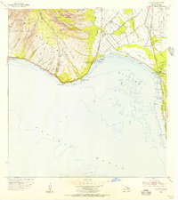
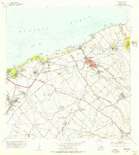
Other maps of this area

1954 · Maui
USGS Topo · 1:250,000
1954 · Maalaea
USGS Topo · 1:24,000
1954 · Paia
USGS Topo · 1:24,000
1954 · Puu O Kali
USGS Topo · 1:24,000
1955 · Olowalu
USGS Topo · 1:24,000

1955 · Wailuku
USGS Topo · 1:24,000

1955 · Kahakuloa
USGS Topo · 1:24,000
1956 · Lahaina
USGS Topo · 1:24,000

1956 · Honolua
USGS Topo · 1:24,000

1966 · Maui
USGS Topo · 1:250,000