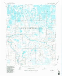
1955 Map of Wainwright A-1
USGS Topo · Published 1983About this map
The National Petroleum Reserve in Alaska dominates this 1955 survey of the North Slope, revealing a landscape defined by an intricate network of waterways and seasonal routes. The Avalik River and Ketik River carve through a terrain characterized by vast marshlands and numerous unnamed ponds, signifying the hydrological complexity of the Arctic tundra. A notable human element in this otherwise sparse environment is the presence of the Reindeer Service USDI Cabins (abandoned), located near the confluence of the Avalik River and Avalitkok Creek. These cabins provide a rare point of reference for historical land use in the region. Transportation is represented by several segments of the Winter Trail, which served as vital connections across the frozen landscape. Other significant water bodies including Takkrak Lake and Irak Creek further detail the geography of this remote territory during the mid-20th century.
Find a feature on this map
13 named features on this map. Tap any name to fly to it.
Don’t see what you’re looking for? This feature index may not catch every label — zoom into the map to look around manually.
Map Details
Editions of this 1955 Wainwright A-1 Map
2 editions found
Other maps of this area

1951 · Utukok River
USGS Topo · 1:250,000

1951 · Meade River
USGS Topo · 1:250,000

1951 · Wainwright
USGS Topo · 1:250,000

1951 · Lookout Ridge
USGS Topo · 1:250,000

1955 · Wainwright
USGS Topo · 1:250,000

1955 · Wainwright A-2
USGS Topo · 1:63,360

1955 · Wainwright B-1
USGS Topo · 1:63,360

1955 · Meade River
USGS Topo · 1:250,000
1955 · Meade River A-5
USGS Topo · 1:63,360
1955 · Meade River B-5
USGS Topo · 1:63,360