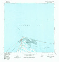
1955 Map of Wainwright B-5 and B-6
USGS Topo · Published 1982About this map
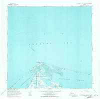
Icy Cape and the shifting barrier islands along the Chukchi Sea define this northern coastline within the National Petroleum Reserve in Alaska. The landscape is dominated by the expansive Kasegaluk Lagoon, separated from open water by narrow sand spits and treacherous navigational hazards like Blossom Shoals. Small-scale human activity is visible through isolated Cabins and a Landing Strip near the point, alongside a small outpost labeled Berlin on the eastern spit. These features, including a prominent 100-foot Tower and a Breakwater, reflect the specialized infrastructure required for mid-century maritime and geological surveying in the high Arctic. The presence of Icy Cape Pass highlights the critical, though often shallow, channels used for navigating between the lagoon and the sea.
Find a feature on this map
12 named features on this map. Tap any name to fly to it.
Don’t see what you’re looking for? This feature index may not catch every label — zoom into the map to look around manually.
Map Details
Editions of this 1955 Wainwright B-5 and B-6 Map
2 editions found
Other maps of this area

1951 · Wainwright
USGS Topo · 1:250,000

1955 · Wainwright
USGS Topo · 1:250,000
1955 · Wainwright A-6 and A-7
USGS Topo · 1:63,360
1955 · Wainwright A-4
USGS Topo · 1:63,360
1955 · Wainwright B-4
USGS Topo · 1:63,360
1955 · Wainwright A-5
USGS Topo · 1:63,360
1955 · Wainwright B-5 and B-6
USGS Topo · 1:63,360

1964 · Wainwright
USGS Topo · 1:250,000
2014 · Wainwright B-6 SE
USGS Topo · 1:25,000
2014 · Wainwright B-5 SW
USGS Topo · 1:25,000