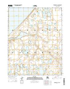
2014 Map of Wainwright C-2 NE
USGS Topo · Published 2014About this map
The Chukchi Sea coastline defines the western edge of this Arctic landscape, where the coastal tundra meets the water. The intricate drainage of the Sinaruruk River meanders across the terrain, reflecting the complex hydrology of the North Slope. Small named locations like Akvat and Ikpiligok appear along the coastal and riverine areas, representing the sparse but vital points of human presence in this region. This 2014 survey documents the distribution of thaw lakes and wetlands that dominate the land between the coast and the inland river reaches. The mapping of t16n r31w and surrounding townships provides a detailed framework for understanding the geographical layout of this part of the North Slope Borough during the early 21st century.
Find a feature on this map
8 named features on this map. Tap any name to fly to it.
Don’t see what you’re looking for? This feature index may not catch every label — zoom into the map to look around manually.
Map Details
Editions of this 2014 Wainwright C-2 NE Map
This is the sole edition of this map. No revisions or reprints were ever made.
Other maps of this area

1951 · Wainwright
USGS Topo · 1:250,000

1955 · Wainwright
USGS Topo · 1:250,000

1955 · Wainwright C-1
USGS Topo · 1:63,360
1955 · Wainwright D-2
USGS Topo · 1:63,360
1955 · Wainwright C-2
USGS Topo · 1:63,360
1955 · Wainwright D-1
USGS Topo · 1:63,360
1962 · Wainwright D-2
USGS Topo · 1:50,000

1964 · Wainwright
USGS Topo · 1:250,000
2014 · Wainwright D-1 SW
USGS Topo · 1:25,000
2014 · Wainwright C-1 NW
USGS Topo · 1:25,000