
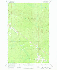
1955 Map of Wakefield NE
USGS Topo · Published 1957About this map
The Chicago and North Western railway cuts a diagonal line through the wooded landscape of the Ottawa National Forest, defining the industrial and transportation corridor of this Upper Peninsula region in the mid-1950s. Small rail-aligned settlements like Hartley and Dunham appear as quiet outposts within the Marenisco and Bessemer districts. The terrain is dominated by the prominent rise of Wolf Mountain and a complex network of waterways, including the Presque Isle River and its various tributaries such as Brotherton Creek and Jackson Creek. Locally significant industrial activity is noted at the Gravel Pits near Dunham, while the northern reaches of the map show the branching flow of the Little Presque Isle River through the Wakefield District. The map captures a moment when timber management and the railroad remained the primary drivers of the local geography before more modern developments altered these remote forest communities.
Find a feature on this map
18 named features on this map. Tap any name to fly to it.
Don’t see what you’re looking for? This feature index may not catch every label — zoom into the map to look around manually.
Map Details
Editions of this 1955 Wakefield NE Map
2 editions found
Other maps of this area

1955 · Marenisco
USGS Topo · 1:62,500

1955 · Marenisco
USGS Topo · 1:24,000

1955 · Wakefield
USGS Topo · 1:24,000

1955 · Wakefield
USGS Topo · 1:62,500

1956 · Bergland
USGS Topo · 1:62,500

1956 · Thomaston
USGS Topo · 1:62,500

1958 · Iron River
USGS Topo · 1:250,000

1960 · Iron River
USGS Topo · 1:250,000

1961 · Iron River
USGS Topo · 1:250,000

1967 · Iron River
USGS Topo · 1:250,000
Featured Places
- Wakefield Township, MI
- Marenisco Township, MI
- Hartley, Marenisco Township
- Dunham, Marenisco Township
- Bessemer Township, MI