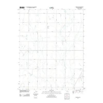
2012 Map of Wakita SE
USGS Topo · Published 2012About this map
Clyde serves as a central point in this rural Grant County landscape, characterized by the expansive grid of the Public Land Survey System. The map documents a predominantly agricultural region defined by the winding paths of Pond Cr and Osage Cr, which intersect the rigid network of section-line roads like e0100 RD and n2910 RD. For those tracing local history, several distinct burial grounds provide a direct link to the area's early residents, including Saint Anthony Cem near the northern border, Fairview Cem in the central section, and Klondike Cem to the south. These cemeteries, alongside water features like Boggy Cr and the industrial Koch Holding Pond A, illustrate the enduring intersection of domestic, agricultural, and industrial land use in northern Oklahoma.
Find a feature on this map
22 named features on this map. Tap any name to fly to it.
Don’t see what you’re looking for? This feature index may not catch every label — zoom into the map to look around manually.
Map Details
Editions of this 2012 Wakita SE Map
This is the sole edition of this map. No revisions or reprints were ever made.
Other maps of this area

1955 · Enid
USGS Topo · 1:250,000

1958 · Enid
USGS Topo · 1:250,000

1968 · Lamont NW
USGS Topo · 1:24,000

1968 · Wakita
USGS Topo · 1:24,000

1968 · Wakita SE
USGS Topo · 1:24,000

1968 · Renfrow
USGS Topo · 1:24,000

1968 · Medford
USGS Topo · 1:24,000

1968 · Pond Creek
USGS Topo · 1:24,000

1968 · Pond Creek NW
USGS Topo · 1:24,000
1968 · Wakita NE
USGS Topo · 1:24,000