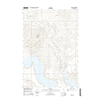
2015 Map of Wakpala
USGS Topo · Published 2015About this map
Wakpala sits at the heart of this landscape, positioned north of the expansive waters of Lake Oahe. The settlement pattern is defined by the intersection of local routes like BIA Rd 44 and 1st Ave S, serving as a central hub in this section of Corson County. To the east of the town center, Saint Bedes Cem provides a specific point of interest for genealogists tracing family histories in the region. The natural geography is dominated by the winding path of Oak Creek, which cuts through the terrain toward the Missouri River reservoir. To the northwest, the prominent rise of Rattlesnake Butte stands as a significant landmark above the surrounding plains. The presence of Deep Bank Cr in the southwest corner further illustrates the intricate drainage systems that define this part of the Standing Rock reservation area.
Find a feature on this map
19 named features on this map. Tap any name to fly to it.
Don’t see what you’re looking for? This feature index may not catch every label — zoom into the map to look around manually.
Map Details
Editions of this 2015 Wakpala Map
This is the sole edition of this map. No revisions or reprints were ever made.
Other maps of this area

1953 · McIntosh
USGS Topo · 1:250,000

1956 · Wakpala NW
USGS Topo · 1:24,000

1956 · Wakpala SE
USGS Topo · 1:24,000

1956 · Wakpala SW
USGS Topo · 1:24,000

1956 · Wakpala
USGS Topo · 1:24,000

1958 · McIntosh
USGS Topo · 1:250,000

1966 · Mahto
USGS Topo · 1:24,000

1966 · Kenel
USGS Topo · 1:24,000

1966 · Kline Buttes
USGS Topo · 1:24,000

1967 · Mobridge NW
USGS Topo · 1:24,000