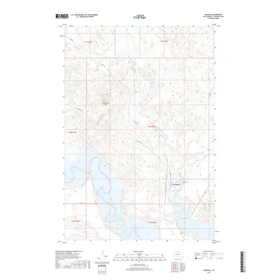
2017 Map of Wakpala
USGS Topo · Published 2017About this map
Wakpala serves as the primary settlement on this Corson County landscape, situated just west of where Oak Creek meets the expansive waters of Lake Oahe. The town's local history is anchored by Saint Bedes Cem, located near the northern edge of the community. The terrain is defined by the sharp transition from the river valley to the rolling heights of the Standing Rock Reservation area, most notably at the prominent Rattlesnake Butte. To the west, the landscape is dissected by several drainages including Deep Bank Cr, while a network of rural routes like Mahto Rd and Snake Butte Rd connect the higher plateaus. A modern local road, Hunk Papa Loop, encircles the residential area of Wakpala, reflecting the contemporary infrastructure of the Lakota community in the early 21st century.
Find a feature on this map
18 named features on this map. Tap any name to fly to it.
Don’t see what you’re looking for? This feature index may not catch every label — zoom into the map to look around manually.
Map Details
Editions of this 2017 Wakpala Map
This is the sole edition of this map. No revisions or reprints were ever made.
Other maps of this area

1953 · McIntosh
USGS Topo · 1:250,000

1956 · Wakpala NW
USGS Topo · 1:24,000

1956 · Wakpala SE
USGS Topo · 1:24,000

1956 · Wakpala SW
USGS Topo · 1:24,000

1956 · Wakpala
USGS Topo · 1:24,000

1958 · McIntosh
USGS Topo · 1:250,000

1966 · Mahto
USGS Topo · 1:24,000

1966 · Kenel
USGS Topo · 1:24,000

1966 · Kline Buttes
USGS Topo · 1:24,000

1967 · Mobridge NW
USGS Topo · 1:24,000