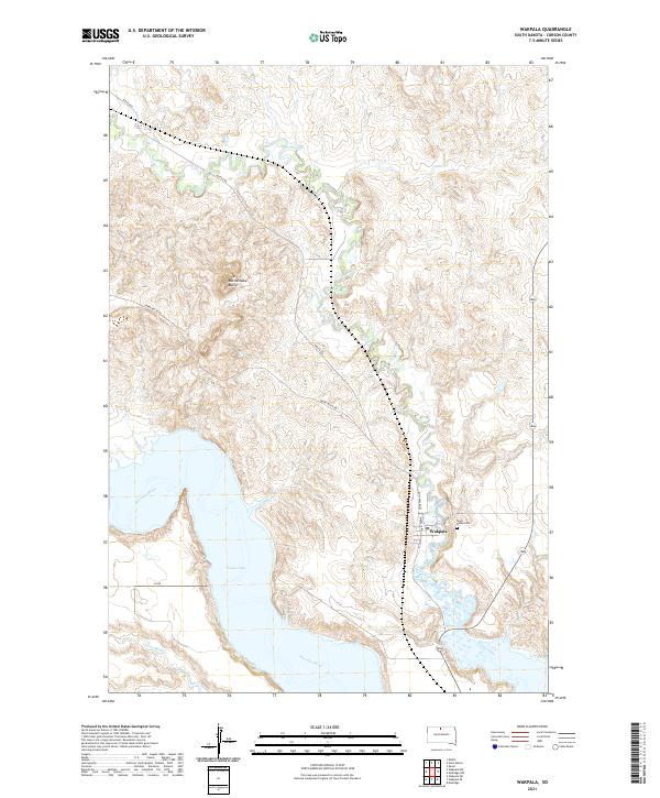
2021 Map of Wakpala
USGS Topo · Published 2021About this map
Wakpala is situated near the eastern edge of the Standing Rock Indian Reservation, where the Missouri River valley transitions into the expansive Lake Oahe. The settlement is bounded by the winding course of Oak Creek, which cuts through the high plains to join the river system. This 2021 survey illustrates the modern landscape of Corson County, showing the intersection of local routes like Hunkpa Loop and Wakpala Rd that serve the community and its surrounding ranchlands.
Find a feature on this map
18 named features on this map. Tap any name to fly to it.
Don’t see what you’re looking for? This feature index may not catch every label — zoom into the map to look around manually.
Map Details
Editions of this 2021 Wakpala Map
This is the sole edition of this map. No revisions or reprints were ever made.
Other maps of this area

1953 · McIntosh
USGS Topo · 1:250,000

1956 · Wakpala NW
USGS Topo · 1:24,000

1956 · Wakpala SE
USGS Topo · 1:24,000

1956 · Wakpala SW
USGS Topo · 1:24,000

1956 · Wakpala
USGS Topo · 1:24,000

1958 · McIntosh
USGS Topo · 1:250,000

1966 · Mahto
USGS Topo · 1:24,000

1966 · Kenel
USGS Topo · 1:24,000

1966 · Kline Buttes
USGS Topo · 1:24,000

1967 · Mobridge NW
USGS Topo · 1:24,000