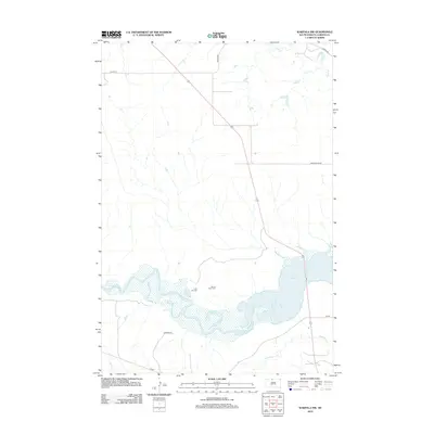
2012 Map of Wakpala NW
USGS Topo · Published 2012About this map
The Grand River snakes through the southern reaches of this landscape, its path eventually meeting the expansive waters of Lake Oahe. This 2012 survey illustrates the rugged, rural character of Corson County, where the topography is defined by the winding drainages of Deep Bank Cr and Oak Cr. The map reveals a sparse but significant human presence, marked by local infrastructure such as Mahto Rd and Snake Butte Rd. For genealogists and local historians, the placement of the Sacred Heart Cem and Long Hill Cem offers vital clues to the community's ancestral footprint. The area's transport network is anchored by Co Hwy-12, providing a sense of the modern arterial connections that cross this expansive terrain near the river's edge.
Find a feature on this map
11 named features on this map. Tap any name to fly to it.
Don’t see what you’re looking for? This feature index may not catch every label — zoom into the map to look around manually.
Map Details
Editions of this 2012 Wakpala NW Map
This is the sole edition of this map. No revisions or reprints were ever made.
Other maps of this area

1953 · McIntosh
USGS Topo · 1:250,000

1956 · Wakpala NW
USGS Topo · 1:24,000

1956 · Little Eagle
USGS Topo · 1:24,000

1956 · Wakpala SE
USGS Topo · 1:24,000

1956 · Little Eagle SE
USGS Topo · 1:24,000

1956 · Wakpala SW
USGS Topo · 1:24,000

1956 · Wakpala
USGS Topo · 1:24,000

1958 · McIntosh
USGS Topo · 1:250,000

1966 · McLaughlin
USGS Topo · 1:24,000

1966 · Mahto
USGS Topo · 1:24,000