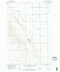
1959 Map of Walcott
USGS Topo · Published 1960About this map
Walcott stands as the central hub of this Red River Valley landscape, situated along the Great Northern rail line as it cuts diagonally through the townships of Walcott and Colfax. Surveyed during the late 1950s, the map reveals a highly structured agricultural grid characteristic of Richland County, punctuated by a distinctive area of complex terrain and depressions in the southwestern portion of the quadrangle. This detailed topographical study, produced for the development of the Missouri River Basin, captures the rural infrastructure of the era, from the established street plan in the town of Walcott to the numerous section roads and drainage patterns that defined the regional economy and local transportation networks.
Find a feature on this map
4 named features on this map. Tap any name to fly to it.
Don’t see what you’re looking for? This feature index may not catch every label — zoom into the map to look around manually.
Map Details
Editions of this 1959 Walcott Map
2 editions found
Other maps of this area

1895 · Fargo
USGS Topo · 1:125,000

1895 · Casselton
USGS Topo · 1:125,000

1897 · Fargo
USGS Topo · 1:125,000

1897 · Casselton
USGS Topo · 1:125,000

1904 · Wahpeton
USGS Topo · 1:125,000

1907 · Wyndmere
USGS Topo · 1:125,000

1953 · Fargo
USGS Topo · 1:250,000

1956 · Fargo
USGS Topo · 1:250,000

1959 · Kindred
USGS Topo · 1:24,000

1959 · Wyndmere NE
USGS Topo · 1:24,000