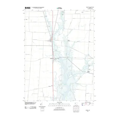
2010 Map of Waldo
USGS Topo · Published 2010About this map
The Olentangy River corridor defines the landscape of this southern Marion County region, where the river's path widens significantly into Delaware Lake. This 2010 survey illustrates a primarily agricultural layout punctuated by numerous family and community burial grounds, including Augenstein Cemetery and Wolfinger Cemetery. The village of Waldo sits as a central hub, containing the Waldo Post Office near the junction of Waldo Western Rd and Waldo Fulton Rd.
Find a feature on this map
67 named features on this map. Tap any name to fly to it.
Don’t see what you’re looking for? This feature index may not catch every label — zoom into the map to look around manually.
Map Details
Editions of this 2010 Waldo Map
This is the sole edition of this map. No revisions or reprints were ever made.
Other maps of this area

1903 · Marion
USGS Topo · 1:62,500

1905 · Marion
USGS Topo · 1:62,500

1913 · Mount Gilead
USGS Topo · 1:62,500

1915 · Marengo
USGS Topo · 1:62,500

1916 · Mount Gilead
USGS Topo · 1:62,500

1924 · Delaware
USGS Topo · 1:62,500

1925 · Delaware
USGS Topo · 1:62,500

1943 · Marengo
USGS Topo · 1:62,500

1943 · Mount Gilead
USGS Topo · 1:62,500

1944 · Delaware
USGS Topo · 1:62,500