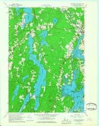
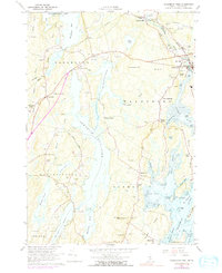
1965 Map of Waldoboro West
USGS Topo · Published 1967About this map
The Medomak River and its intricate tidal flats define the eastern edge of this coastal Maine landscape, where the Maine Central RR cuts through the heart of Waldoboro. This mid-1960s survey captures the distinct transition from the forested hills of the interior, such as Benner Hill and Cordwood Hill, to the complex waterway systems of Pemaquid Pond and Damariscotta Lake. The map reveals a high density of small, named crossroads settlements including Eugley Corner, Sprague Corner, and Harrington Corner, reflecting a community structure built around historic family homesteads and local trade. Cultural landmarks like St Pauls Chapel, the Miller School, and the Johnston Hill Lookout Tower provide specific points of reference for genealogists. The topography is also dotted with numerous Gravel Pits, signaling the local extraction industries that operated alongside the region's agricultural and maritime traditions.
Find a feature on this map
71 named features on this map. Tap any name to fly to it.
Don’t see what you’re looking for? This feature index may not catch every label — zoom into the map to look around manually.
Map Details
Editions of this 1965 Waldoboro West Map
5 editions found
Other maps of this area

1893 · Wiscasset
USGS Topo · 1:62,500

1893 · Boothbay
USGS Topo · 1:62,500

1904 · Monhegan
USGS Topo · 1:62,500

1906 · Monhegan
USGS Topo · 1:62,500

1913 · Waldoboro
USGS Topo · 1:48,000

1915 · Waldoboro
USGS Topo · 1:62,500

1941 · Waldoboro
USGS Topo · 1:62,500

1941 · Boothbay
USGS Topo · 1:62,500

1943 · Boothbay
USGS Topo · 1:62,500

1944 · Wiscasset
USGS Topo · 1:62,500