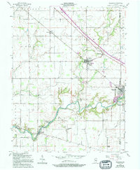
1956 Map of Waldron
USGS Topo · Published 1994About this map
Waldron and Saint Paul serve as the primary hubs in this mid-century portrait of southeastern Shelby County. The Flatrock River winds across the southern landscape, its banks dotted with small communities and recreation sites like Pleasure Valley and Camp Flat Rock. This area reflects a classic Indiana agricultural and transport network, where the Penn Central railroad line and Vandalia Road parallel the river's path, connecting established towns with outlying rural settlements like Geneva and Germantown. Local life is anchored by dispersed landmarks including Wesley Chapel, Valley Ch, and St Vincents Sch, while the presence of a Stone Quarry near Saint Paul points to the area's geological industry. Numerous family and community burial grounds, such as Vienna Cem and Simmons Cem, are clearly marked for those tracing regional genealogy.
Find a feature on this map
41 named features on this map. Tap any name to fly to it.
Don’t see what you’re looking for? This feature index may not catch every label — zoom into the map to look around manually.
Map Details
Editions of this 1956 Waldron Map
5 editions found
Other maps of this area

1942 · Columbus
USGS Topo · 1:125,000

1947 · Hope
USGS Topo · 1:24,000

1948 · Hope
USGS Topo · 1:24,000

1948 · Lewis Creek
USGS Topo · 1:24,000

1950 · Edinburg
USGS Topo · 1:62,500

1953 · Shelbyville
USGS Topo · 1:24,000

1953 · Cincinnati
USGS Topo · 1:250,000

1956 · Waldron
USGS Topo · 1:24,000

1956 · Rays Crossing
USGS Topo · 1:24,000

1957 · Cincinnati
USGS Topo · 1:250,000