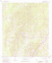
1963 Map of Waldrup
USGS Topo · Published 1982About this map
The rural landscape of Jasper County is defined by a dense network of watercourses and scattered community centers in the early 1960s. The settlement of Waldrup sits at a junction in the northwest, while the town of Heidelberg occupies the southeastern corner, serving as a hub for the local area. The terrain is deeply carved by the Tallahala Creek and its many tributaries, including Bogue Ealiah and Tallahattah Creek.
Find a feature on this map
25 named features on this map. Tap any name to fly to it.
Don’t see what you’re looking for? This feature index may not catch every label — zoom into the map to look around manually.
Map Details
Editions of this 1963 Waldrup Map
3 editions found
Other maps of this area

1953 · Hattiesburg
USGS Topo · 1:250,000

1953 · Meridian
USGS Topo · 1:250,000

1957 · Meridian
USGS Topo · 1:250,000

1957 · Enterprise
USGS Topo · 1:62,500

1958 · Hattiesburg
USGS Topo · 1:250,000

1963 · Waldrup
USGS Topo · 1:24,000

1963 · Heidelberg
USGS Topo · 1:24,000

1964 · Heidelberg SW
USGS Topo · 1:24,000

1964 · Moss
USGS Topo · 1:24,000

1964 · Sandersville
USGS Topo · 1:24,000