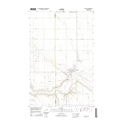
2014 Map of Walhalla
USGS Topo · Published 2014About this map
Walhalla sits at the edge of the Pembina Hills, where the land drops away toward the winding course of the Pembina River. This 2014 survey captures the township's layout, showing a residential grid that includes streets like Delano Ave and Emmerling Ave alongside the Walhalla Municipal Airport. The terrain to the west and south is significantly more complex, marked by the sharp elevation changes of the hills and the prominent Lookout Point overlooking the river valley. To the south, the map identifies the small community of Pembina Valley near the Cavalier and Pembina county line. Local history is anchored at the Walhalla Cemetery and by the network of section-line roads such as 109th St NE and 125th Ave NE that define the agricultural landscape surrounding the settlement.
Find a feature on this map
43 named features on this map. Tap any name to fly to it.
Don’t see what you’re looking for? This feature index may not catch every label — zoom into the map to look around manually.
Map Details
Editions of this 2014 Walhalla Map
This is the sole edition of this map. No revisions or reprints were ever made.
Other maps of this area

1918 · Walhalla
USGS Topo · 1:62,500

1943 · Walhalla
USGS Topo · 1:62,500

1952 · Thief River Falls
USGS Topo · 1:250,000

1953 · Devils Lake
USGS Topo · 1:250,000

1956 · Thief River Falls
USGS Topo · 1:250,000

1956 · Devils Lake
USGS Topo · 1:250,000

1957 · Thief River Falls
USGS Topo · 1:250,000

1964 · Hallson
USGS Topo · 1:24,000

1964 · Leroy
USGS Topo · 1:24,000

1964 · Walhalla
USGS Topo · 1:24,000