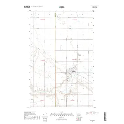
2017 Map of Walhalla
USGS Topo · Published 2017About this map
The Pembina River winds through a deep, wooded valley as it carves through the Pembina Hills near the North Dakota-Manitoba border. This survey captures the settlement of Walhalla, where a grid of streets including Central Ave and Mountain Ave centers on the river's northern banks. The landscape transition is stark, moving from the flat, section-lined agricultural fields of the Red River Valley into the elevated, dissected terrain of the hills. Local history is anchored at the Walhalla Cem and the prominent Lookout Point, which offers views over the valley floor. The map also delineates the boundary between Cavalier and Pembina counties, marking the western edge of the community's influence near Pembina Valley and the Walhalla Municipal Airport.
Find a feature on this map
50 named features on this map. Tap any name to fly to it.
Don’t see what you’re looking for? This feature index may not catch every label — zoom into the map to look around manually.
Map Details
Editions of this 2017 Walhalla Map
This is the sole edition of this map. No revisions or reprints were ever made.
Other maps of this area

1918 · Walhalla
USGS Topo · 1:62,500

1943 · Walhalla
USGS Topo · 1:62,500

1952 · Thief River Falls
USGS Topo · 1:250,000

1953 · Devils Lake
USGS Topo · 1:250,000

1956 · Thief River Falls
USGS Topo · 1:250,000

1956 · Devils Lake
USGS Topo · 1:250,000

1957 · Thief River Falls
USGS Topo · 1:250,000

1964 · Hallson
USGS Topo · 1:24,000

1964 · Leroy
USGS Topo · 1:24,000

1964 · Walhalla
USGS Topo · 1:24,000