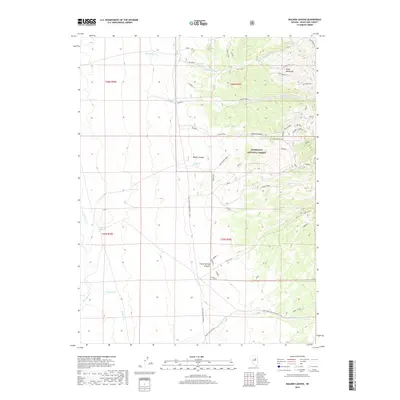
2018 Map of Walker Canyon
USGS Topo · Published 2018About this map
The Ruby Mountains define the high terrain of this portion of Humboldt National Forest, where steep drainages and isolated springs dictate the movement through the Great Basin landscape. Numerous canyons, including Walker Canyon and Cherry Spring Canyon, cut through the ridges, while the lower elevations are marked by the Alkali Flat and the meandering course of Huntington Cr.
Find a feature on this map
95 named features on this map. Tap any name to fly to it.
Don’t see what you’re looking for? This feature index may not catch every label — zoom into the map to look around manually.
Map Details
Editions of this 2018 Walker Canyon Map
This is the sole edition of this map. No revisions or reprints were ever made.
Other maps of this area

1934 · Jiggs
USGS Topo · 1:125,000

1937 · Jiggs
USGS Topo · 1:125,000

1955 · Elko
USGS Topo · 1:250,000

1956 · Ely
USGS Topo · 1:250,000

1957 · Diamond Springs
USGS Topo · 1:62,500

1957 · Cold Creek Ranch
USGS Topo · 1:62,500

1958 · Elko
USGS Topo · 1:250,000

1959 · Ely
USGS Topo · 1:250,000

1959 · Railroad Pass
USGS Topo · 1:62,500

1959 · Sherman Mtn
USGS Topo · 1:62,500