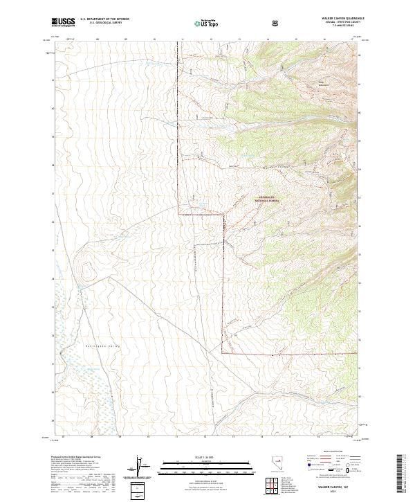
2021 Map of Walker Canyon
USGS Topo · Published 2021About this map
The Ruby Mountains and the Humboldt National Forest dominate this high-desert landscape, where the peaks descend into the wide expanse of Huntington Valley. A vital throughway for early regional transit, the Elko Hamilton Stage Rd traces a path through the southern flats, signaling the historical importance of stagecoach routes connecting mining districts. The terrain is defined by dramatic erosional features like Walker Canyon and Cherry Spring Canyon, which channel seasonal water from springs such as Tub Spring and Aurora Spring toward the valley floor. Researchers will find a dense network of forest trails, including the Pony Trl and Juaristi 1 Trl, which navigate the slopes between Sestanovich Cr and the expansive Alkali Flat. These paths provide a detailed record of land use and resource management in White Pine County.
Find a feature on this map
53 named features on this map. Tap any name to fly to it.
Don’t see what you’re looking for? This feature index may not catch every label — zoom into the map to look around manually.
Map Details
Editions of this 2021 Walker Canyon Map
This is the sole edition of this map. No revisions or reprints were ever made.
Other maps of this area

1934 · Jiggs
USGS Topo · 1:125,000

1937 · Jiggs
USGS Topo · 1:125,000

1955 · Elko
USGS Topo · 1:250,000

1956 · Ely
USGS Topo · 1:250,000

1957 · Diamond Springs
USGS Topo · 1:62,500

1957 · Cold Creek Ranch
USGS Topo · 1:62,500

1958 · Elko
USGS Topo · 1:250,000

1959 · Ely
USGS Topo · 1:250,000

1959 · Railroad Pass
USGS Topo · 1:62,500

1959 · Sherman Mtn
USGS Topo · 1:62,500