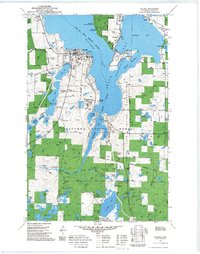
1972 Map of Walker
USGS Topo · Published 1990About this map
Leech Lake dominates this northern landscape, its irregular shoreline forming Walker Bay and Agency Bay around the city of Walker. This 1972 survey, updated with late-1980s data, details the convergence of institutional and recreational land use within the Chippewa National Forest. Notable landmarks include the Ah-gwah-ching State Nursing Home and the Tianna Country Club south of the city. The area's cultural history is marked by the Leech Lake Indian Reservation Boundary and several local burial grounds, including Evergreen Cem, Pagan Cem, and St Agnes Cem near Onigum. Transportation and leisure are intertwined throughout the quadrangle, from the Railroad Heartland Trail to the Drive-in Theater and the Hunter Walking Trail System near Portage Lake. Numerous smaller water bodies like Lake May and Tenmile Lake define the terrain, supporting the region's character as a hub for both permanent settlement and seasonal residence.
Find a feature on this map
64 named features on this map. Tap any name to fly to it.
Don’t see what you’re looking for? This feature index may not catch every label — zoom into the map to look around manually.
Map Details
Editions of this 1972 Walker Map
2 editions found
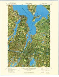
Other maps of this area

1953 · Brainerd
USGS Topo · 1:250,000

1954 · Bemidji
USGS Topo · 1:250,000

1957 · Brainerd
USGS Topo · 1:250,000

1957 · Bemidji
USGS Topo · 1:250,000

1958 · Bemidji
USGS Topo · 1:250,000

1958 · Brainerd
USGS Topo · 1:250,000

1965 · Brainerd
USGS Topo · 1:250,000

1970 · Hackensack
USGS Topo · 1:24,000

1970 · Webb Lake
USGS Topo · 1:24,000
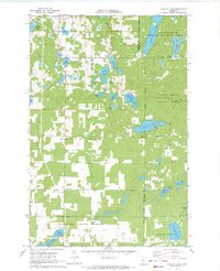
1970 · Crystal Lake
USGS Topo · 1:24,000