
1964 Map of Walker Lake
USGS Topo · Published 1964About this map
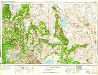
Walker Lake and the high desert of the Great Basin meet the eastern front of the Sierra Nevada in this mid-century mapping. The industrial and military footprint of the era is evident at the Naval Ammunition Depot near Hawthorne and the massive Anaconda Copper Mine just east of Yerington. To the south and west, the landscape transitions into the high peaks of Yosemite National Park, including Half Dome and El Capitan. The map documents the enduring remains of the region's mining heritage, noting the sites of Bodie (ruins), Belleville (ruins), and Candelaria (ruins). Transportation is dominated by the Southern Pacific rail lines and the networks of roads like Route 395 and 95 that connect the scattered settlements of Schurz, Bridgeport, and Mina through the valleys between the Wassuk Range and the Gillis Range.
Find a feature on this map
138 named features on this map. Tap any name to fly to it.
Don’t see what you’re looking for? This feature index may not catch every label — zoom into the map to look around manually.
Map Details
Editions of this 1964 Walker Lake Map
2 editions found
Other maps of this area

1889 · Pyramid Peak
USGS Topo · 1:125,000

1889 · Markleeville
USGS Topo · 1:125,000

1891 · Carson
USGS Topo · 1:125,000

1891 · Markleeville
USGS Topo · 1:125,000

1891 · Truckee
USGS Topo · 1:125,000

1891 · Big Trees
USGS Topo · 1:125,000

1891 · Wabuska
USGS Topo · 1:125,000

1891 · Pyramid Peak
USGS Topo · 1:125,000

1891 · Wellington
USGS Topo · 1:125,000

1893 · Carson
USGS Topo · 1:125,000