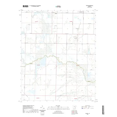
2020 Map of Walker
USGS Topo · Published 2020About this map
Bayou Des Arc and Cypress Bayou snake across this central Arkansas landscape, defining the low-lying drainage patterns that separate White and Prairie counties. The settlement of Griffithville occupies the northeastern corner, serving as a focal point near the crossing of McDoniel Rd and Walker Rd. Further west, the small community of Walker is marked by the Walker Cem, while the central rural stretches are punctuated by family-named landmarks and water features like Cheek Lake and Stewarts Reservoir. The intricate network of waterways, including Carsons Slough and Dogwood Cr, illustrates a terrain dominated by wetlands and seasonal flows. Local family history is rooted in the dispersed farmsteads connected by thoroughfares such as Gafford Rd, Fletcher Ellis Rd, and Britton Ford Rd.
Find a feature on this map
58 named features on this map. Tap any name to fly to it.
Don’t see what you’re looking for? This feature index may not catch every label — zoom into the map to look around manually.
Map Details
Editions of this 2020 Walker Map
This is the sole edition of this map. No revisions or reprints were ever made.
Other maps of this area

1932 · Kensett
USGS Topo · 1:62,500

1935 · Kensett
USGS Topo · 1:62,500

1935 · Hazen
USGS Topo · 1:62,500

1940 · Lonoke
USGS Topo · 1:62,500

1941 · Hazen
USGS Topo · 1:62,500

1948 · Helena
USGS Topo · 1:250,000

1949 · Lonoke
USGS Topo · 1:62,500

1950 · Helena
USGS Topo · 1:250,000

1950 · Lonoke
USGS Topo · 1:62,500

1953 · Memphis
USGS Topo · 1:250,000