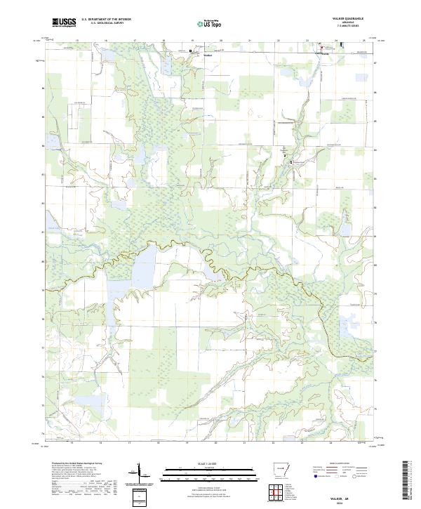
2024 Map of Walker
USGS Topo · Published 2024About this map
Walker and Griffithville anchor this survey of the low-lying wetlands and agricultural drainages along the border of White and Prairie Counties. The landscape is defined by the winding course of Bayou Des Arc and its complex network of tributaries, including Cypress Bayou, Dogwood Creek, and Powell Creek. This area illustrates a classic Arkansas Delta drainage pattern, where sloughs and creeks like Carsons Slough and White Creek weave through a patchwork of rural roads and section lines.
Find a feature on this map
57 named features on this map. Tap any name to fly to it.
Don’t see what you’re looking for? This feature index may not catch every label — zoom into the map to look around manually.
Map Details
Editions of this 2024 Walker Map
This is the sole edition of this map. No revisions or reprints were ever made.
Other maps of this area

1932 · Kensett
USGS Topo · 1:62,500

1935 · Kensett
USGS Topo · 1:62,500

1935 · Hazen
USGS Topo · 1:62,500

1940 · Lonoke
USGS Topo · 1:62,500

1941 · Hazen
USGS Topo · 1:62,500

1948 · Helena
USGS Topo · 1:250,000

1949 · Lonoke
USGS Topo · 1:62,500

1950 · Helena
USGS Topo · 1:250,000

1950 · Lonoke
USGS Topo · 1:62,500

1953 · Memphis
USGS Topo · 1:250,000