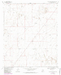
1970 Map of Walking Cane Ranch
USGS Topo · Published 1985About this map
The Oil Field dominates the high plains of Lea County, New Mexico, in this mid-century topographic survey. The landscape is defined by an extensive network of pipelines and drill holes, reflecting the intensive energy production of the era. Scattered throughout this industrial setting are isolated outposts like Walking Cane Ranch and the settlement of Warren, which appear alongside numerous water-pumping landmarks essential for survival in this arid environment. Names such as Antelope Windmill, Lambert Windmill, and Oil Well Windmill mark the terrain, highlighting the reliance on groundwater to support both ranching and the oil industry. The inclusion of various Gravel Pits further emphasizes the extractive nature of the local economy during the 1970s.
Find a feature on this map
16 named features on this map. Tap any name to fly to it.
Don’t see what you’re looking for? This feature index may not catch every label — zoom into the map to look around manually.
Map Details
Editions of this 1970 Walking Cane Ranch Map
2 editions found
Other maps of this area

1954 · Brownfield
USGS Topo · 1:250,000

1958 · Brownfield
USGS Topo · 1:250,000

1962 · Brownfield
USGS Topo · 1:250,000

1970 · Bronco NE
USGS Topo · 1:24,000

1970 · Walking Cane Ranch
USGS Topo · 1:24,000

1970 · Gladiola
USGS Topo · 1:24,000

1970 · Ranger Lake
USGS Topo · 1:24,000

1970 · Bronco
USGS Topo · 1:24,000

1970 · Tatum North
USGS Topo · 1:24,000

1970 · Bledsoe
USGS Topo · 1:24,000