
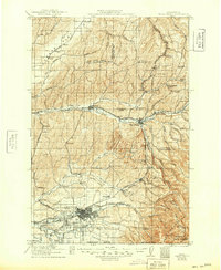
1921 Map of Walla Walla
USGS Topo · Published 1921About this map
Walla Walla and its surrounding wheat country are meticulously detailed in this early 20th-century survey, showing the complex web of irrigation and transportation that sustained the region. The map centers on the hub of Walla Walla, including the State Penitentiary and College Place, while the Whitman Monument stands as a marker of the area's frontier history. To the north, the vast Eureka Flat is etched with numerous hollows like Smith Hollow and Badger Hollow, connected by the Northern Pacific and Oregon-Washington Railroad & Navigation Co lines.
Find a feature on this map
91 named features on this map. Tap any name to fly to it.
Don’t see what you’re looking for? This feature index may not catch every label — zoom into the map to look around manually.
Map Details
Editions of this 1921 Walla Walla Map
2 editions found
Other maps of this area

1915 · Wallulah
USGS Topo · 1:96,000

1916 · Connell
USGS Topo · 1:125,000

1918 · Connell
USGS Topo · 1:125,000

1918 · Wallula
USGS Topo · 1:125,000

1919 · Walla Walla
USGS Topo · 1:125,000

1935 · Pendleton
USGS Topo · 1:125,000

1937 · Pomeroy
USGS Topo · 1:96,000

1942 · Pomeroy
USGS Topo · 1:125,000

1948 · Starbuck
USGS Topo · 1:62,500

1948 · Ayer
USGS Topo · 1:62,500