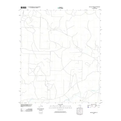
2010 Map of Wallace Draw
USGS Topo · Published 2010About this map
Middle Concho River flows across the southern portion of this West Texas landscape, providing a critical water source in an otherwise arid environment defined by seasonal drainages. The Sugg Ranch headquarters stands near the river, reflecting the region's enduring ranching heritage. North of the river, the terrain is marked by the winding path of Dry Creek and a network of rural routes that facilitate movement through the open range. Local infrastructure is highlighted by uniquely named thoroughfares such as Hell Hole Rd and Cattle Guard 8 Rd, which underscore the practical and sometimes colorful nature of navigation in Irion County. This document captures the intersection of ranching life and geography just as digital mapping standards were being refined by the U.S. Geological Survey.
Find a feature on this map
6 named features on this map. Tap any name to fly to it.
Don’t see what you’re looking for? This feature index may not catch every label — zoom into the map to look around manually.
Map Details
Editions of this 2010 Wallace Draw Map
This is the sole edition of this map. No revisions or reprints were ever made.
Other maps of this area

1895 · Sherwood
USGS Topo · 1:125,000

1921 · Ketchum Mountain
USGS Topo · 1:62,500

1923 · Ketchum Mountain
USGS Topo · 1:62,500

1954 · San Angelo
USGS Topo · 1:250,000

1958 · San Angelo
USGS Topo · 1:250,000

1965 · San Angelo
USGS Topo · 1:250,000

1972 · Arden
USGS Topo · 1:24,000

1972 · Wallace Draw
USGS Topo · 1:24,000
1972 · Mertzon SW
USGS Topo · 1:24,000

1972 · Dog Creek SW
USGS Topo · 1:24,000