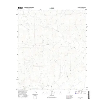
2016 Map of Wallace Draw
USGS Topo · Published 2016About this map
Middle Concho River defines the southern reach of this West Texas landscape, where the terrain is marked by the long drainage systems of Wallace Draw and Big Hollow Draw. This Irion County survey illustrates a high-desert environment characterized by ephemeral watercourses such as Dry Cr, which cuts across the northern and eastern portions of the quadrangle. The infrastructure consists primarily of ranch and county roads that navigate the complex topography of draws and plateaus.
Find a feature on this map
10 named features on this map. Tap any name to fly to it.
Don’t see what you’re looking for? This feature index may not catch every label — zoom into the map to look around manually.
Map Details
Editions of this 2016 Wallace Draw Map
This is the sole edition of this map. No revisions or reprints were ever made.
Other maps of this area

1895 · Sherwood
USGS Topo · 1:125,000

1921 · Ketchum Mountain
USGS Topo · 1:62,500

1923 · Ketchum Mountain
USGS Topo · 1:62,500

1954 · San Angelo
USGS Topo · 1:250,000

1958 · San Angelo
USGS Topo · 1:250,000

1965 · San Angelo
USGS Topo · 1:250,000

1972 · Arden
USGS Topo · 1:24,000

1972 · Wallace Draw
USGS Topo · 1:24,000
1972 · Mertzon SW
USGS Topo · 1:24,000

1972 · Dog Creek SW
USGS Topo · 1:24,000