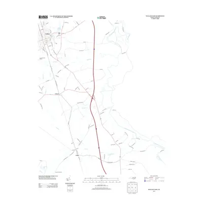
2013 Map of Wallace East
USGS Topo · Published 2013About this map
Wallace serves as the primary hub in this corner of Pender and Duplin counties, where the grid of city streets transitions into the wooded lowlands of the Coastal Plain. The landscape is defined by the winding course of the Northeast Cape Fear River and its many tributaries, including Rockfish Cr and Sawyer Cr. To the south, the community of Watha sits near the small waters of Lewis Cr, while the planned residential patterns of the Penderlea Homesteads and the neighboring Penderlea Lake reflect the unique mid-century rural development of the region. The transport network is anchored by several rail-adjacent roads like NW Railroad St and SE Railroad St, which historically served the agricultural centers of Tin City and Willard. Infrastructure for the modern era is represented by the Henderson Field Airport and the corridor of Interstate 40 crossing the terrain.
Find a feature on this map
93 named features on this map. Tap any name to fly to it.
Don’t see what you’re looking for? This feature index may not catch every label — zoom into the map to look around manually.
Map Details
Editions of this 2013 Wallace East Map
This is the sole edition of this map. No revisions or reprints were ever made.
Other maps of this area

1942 · Burgaw
USGS Topo · 1:62,500

1943 · Kenansville
USGS Topo · 1:62,500

1948 · Kenansville
USGS Topo · 1:62,500

1953 · Florence
USGS Topo · 1:250,000

1953 · Beaufort
USGS Topo · 1:250,000

1954 · Florence
USGS Topo · 1:250,000

1954 · Beaufort
USGS Topo · 1:250,000

1955 · Atkinson
USGS Topo · 1:62,500

1962 · Rose Hill
USGS Topo · 1:62,500

1972 · Beaufort
USGS Topo · 1:250,000