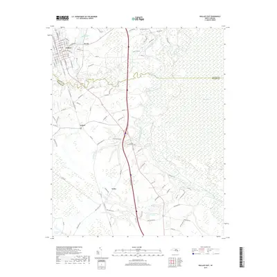
2019 Map of Wallace East
USGS Topo · Published 2019About this map
The Northeast Cape Fear River meanders through a landscape defined by extensive wetlands and small railroad towns in this modern survey. The town of Wallace serves as a primary hub in the northwest corner, where a dense grid of streets like E Main St and S Norwood St meet the CSX rail line. To the south, the smaller settlements of Willard and Watha follow this same transport corridor, reflecting a long history of rail-dependent commerce.
Find a feature on this map
104 named features on this map. Tap any name to fly to it.
Don’t see what you’re looking for? This feature index may not catch every label — zoom into the map to look around manually.
Map Details
Editions of this 2019 Wallace East Map
This is the sole edition of this map. No revisions or reprints were ever made.
Other maps of this area

1942 · Burgaw
USGS Topo · 1:62,500

1943 · Kenansville
USGS Topo · 1:62,500

1948 · Kenansville
USGS Topo · 1:62,500

1953 · Florence
USGS Topo · 1:250,000

1953 · Beaufort
USGS Topo · 1:250,000

1954 · Florence
USGS Topo · 1:250,000

1954 · Beaufort
USGS Topo · 1:250,000

1955 · Atkinson
USGS Topo · 1:62,500

1962 · Rose Hill
USGS Topo · 1:62,500

1972 · Beaufort
USGS Topo · 1:250,000