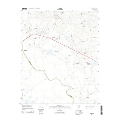
2014 Map of Wallace
USGS Topo · Published 2014About this map
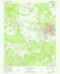
The Great Pee Dee River forms the natural boundary between Marlboro and Chesterfield counties, winding south past the community of Cheraw. This 2014 survey documents a landscape defined by significant water management and small agricultural settlements. Several historical millponds, including Anderson Millpond, McLaurins Millpond, and Davids Millpond, suggest a long history of water-driven industry along the tributaries of Beaverdam Cr and Naked Cr. Local genealogy is well-preserved through numerous family and community burial sites such as White Oak Cem, Quick Cem, and Ebenezer Cem. The map illustrates the contemporary layout of settlements like Wallace and Chavistown, where residential development follows a network of secondary roads such as Old Wire Rd W and Hickory Grove Rd. This period of the 2010s shows a mix of recreational water bodies like Girl Scout Pond alongside the established rural infrastructure of Montrose and Madeline.
Find a feature on this map
98 named features on this map. Tap any name to fly to it.
Don’t see what you’re looking for? This feature index may not catch every label — zoom into the map to look around manually.
Map Details
Editions of this 2014 Wallace Map
This is the sole edition of this map. No revisions or reprints were ever made.
Other maps of this area

1942 · Rockingham
USGS Topo · 1:125,000

1949 · Ghio
USGS Topo · 1:24,000

1949 · Hamlet
USGS Topo · 1:62,500

1953 · Florence
USGS Topo · 1:250,000

1954 · Florence
USGS Topo · 1:250,000
1971 · Diggs
USGS Topo · 1:24,000
1971 · Morven East
USGS Topo · 1:24,000
1971 · Wallace
USGS Topo · 1:24,000
1971 · Cheraw
USGS Topo · 1:24,000

1971 · Society Hill
USGS Topo · 1:24,000