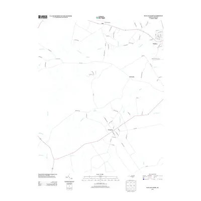
2013 Map of Wallace West
USGS Topo · Published 2013About this map
The agrarian community of Penderlea and the western outskirts of Wallace anchor this landscape, illustrating the late-20th-century character of Pender County. The area is defined by a dense network of watercourses, including the winding Rockfish Cr and Moores Cr, which dictate the placement of roads like Willard Rd and Englishtown Rd. Small settlements such as Sunnyside and Safe are interspersed between the drainages of Sills Cr and Doctors Cr, reflecting a rural settlement pattern where aviation also plays a role. Both Safe Field Airport and Henderson Field Airport are situated here, suggesting the importance of private and regional flight in this part of North Carolina. Numerous family-named roads, such as Bea Williams Rd and Jesse Lanier Ln, offer specific geographical points of interest for those researching local lineage and land use in the early 2010s.
Find a feature on this map
73 named features on this map. Tap any name to fly to it.
Don’t see what you’re looking for? This feature index may not catch every label — zoom into the map to look around manually.
Map Details
Editions of this 2013 Wallace West Map
This is the sole edition of this map. No revisions or reprints were ever made.
Other maps of this area

1942 · Burgaw
USGS Topo · 1:62,500

1943 · Kenansville
USGS Topo · 1:62,500

1948 · Kenansville
USGS Topo · 1:62,500

1953 · Florence
USGS Topo · 1:250,000

1953 · Beaufort
USGS Topo · 1:250,000

1954 · Florence
USGS Topo · 1:250,000

1954 · Beaufort
USGS Topo · 1:250,000

1955 · Atkinson
USGS Topo · 1:62,500

1962 · Rose Hill
USGS Topo · 1:62,500

1972 · Beaufort
USGS Topo · 1:250,000