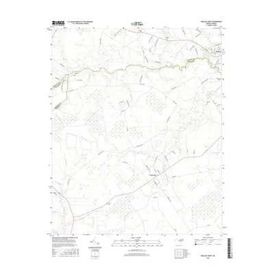
2016 Map of Wallace West
USGS Topo · Published 2016About this map
Penderlea and the western outskirts of Wallace anchor this 2016 survey, where the Coastal Plain landscape is defined by its intricate network of blackwater streams and family cemeteries. The terrain is marked by the meandering paths of Rockfish Cr and Sills Cr, which drain the low-lying agricultural and forested lands. Genealogists will find a wealth of local history in the numerous small burial grounds scattered throughout the landscape, including Alderman Cem, Newkirk Cem, and Gurganus Cem. The map illustrates a rural economy centered on roads like Englishtown Rd and Willard Rd, connecting isolated farmsteads to the regional hubs. Aviation history is noted by the presence of Henderson Field and Safe Field, serving the aviation needs of Pender and Duplin counties. The boundary between Duplin, Sampson, and Pender counties cuts through the swampy headwaters, highlighting the historical administrative divisions in this corner of North Carolina.
Find a feature on this map
72 named features on this map. Tap any name to fly to it.
Don’t see what you’re looking for? This feature index may not catch every label — zoom into the map to look around manually.
Map Details
Editions of this 2016 Wallace West Map
This is the sole edition of this map. No revisions or reprints were ever made.
Other maps of this area

1942 · Burgaw
USGS Topo · 1:62,500

1943 · Kenansville
USGS Topo · 1:62,500

1948 · Kenansville
USGS Topo · 1:62,500

1953 · Florence
USGS Topo · 1:250,000

1953 · Beaufort
USGS Topo · 1:250,000

1954 · Florence
USGS Topo · 1:250,000

1954 · Beaufort
USGS Topo · 1:250,000

1955 · Atkinson
USGS Topo · 1:62,500

1962 · Rose Hill
USGS Topo · 1:62,500

1972 · Beaufort
USGS Topo · 1:250,000