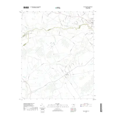
2019 Map of Wallace West
USGS Topo · Published 2019About this map
Wallace and the planned agricultural community of Penderlea anchor this corner of the Coastal Plain, where Duplin, Sampson, and Pender counties meet. The landscape is defined by a dense network of watercourses, including Rockfish Cr and Moores Cr, which historically dictated the pattern of early settlement and road placement. The prevalence of family-named landmarks and rural burial grounds such as Alderman Cem, White Cem, and Gurganus Cem provides significant genealogical context for the region's long-standing families. Transportation is centralized around the hub at Wallace, where routes like W Main St and Boney Bridge RD connect the town to outlying aviation sites like Henderson Field. The map reveals a transition from these structured town centers to the grid-like rural road systems that support the area's agricultural heritage.
Find a feature on this map
74 named features on this map. Tap any name to fly to it.
Don’t see what you’re looking for? This feature index may not catch every label — zoom into the map to look around manually.
Map Details
Editions of this 2019 Wallace West Map
This is the sole edition of this map. No revisions or reprints were ever made.
Other maps of this area

1942 · Burgaw
USGS Topo · 1:62,500

1943 · Kenansville
USGS Topo · 1:62,500

1948 · Kenansville
USGS Topo · 1:62,500

1953 · Florence
USGS Topo · 1:250,000

1953 · Beaufort
USGS Topo · 1:250,000

1954 · Florence
USGS Topo · 1:250,000

1954 · Beaufort
USGS Topo · 1:250,000

1955 · Atkinson
USGS Topo · 1:62,500

1962 · Rose Hill
USGS Topo · 1:62,500

1972 · Beaufort
USGS Topo · 1:250,000