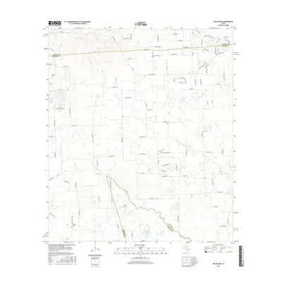
2016 Map of Waller NW
USGS Topo · Published 2016About this map
Kirby Chapel and the small Rosenau Cem sit among a landscape of sprawling ranch land and creek drainages where Waller, Harris, and Grimes counties meet. The terrain is defined by the headwaters of numerous systems, including Threemile Cr, Gladish Cr, and Spring Cr, which carve through the countryside alongside smaller water bodies like Japhet Lake and Lynch Lake. Modern rural infrastructure is evidenced by a dense network of country roads such as Skymac Ranch Rd and Fields Store Rd, reflecting the mid-2010s land use patterns of this Texas coastal prairie region. The proximity of these county lines highlights the historical transition between agricultural ventures and the gradual outward reach of the Greater Houston area.
Find a feature on this map
108 named features on this map. Tap any name to fly to it.
Don’t see what you’re looking for? This feature index may not catch every label — zoom into the map to look around manually.
Map Details
Editions of this 2016 Waller NW Map
This is the sole edition of this map. No revisions or reprints were ever made.
Other maps of this area

1914 · Navasota
USGS Topo · 1:62,500

1916 · Hockley
USGS Topo · 1:24,000

1920 · Hockley
USGS Topo · 1:31,680

1920 · Waller
USGS Topo · 1:31,680

1954 · Beaumont
USGS Topo · 1:250,000

1954 · Austin
USGS Topo · 1:250,000

1956 · Hempstead
USGS Topo · 1:62,500

1957 · Beaumont
USGS Topo · 1:250,000

1958 · Courtney
USGS Topo · 1:24,000

1960 · Waller
USGS Topo · 1:24,000