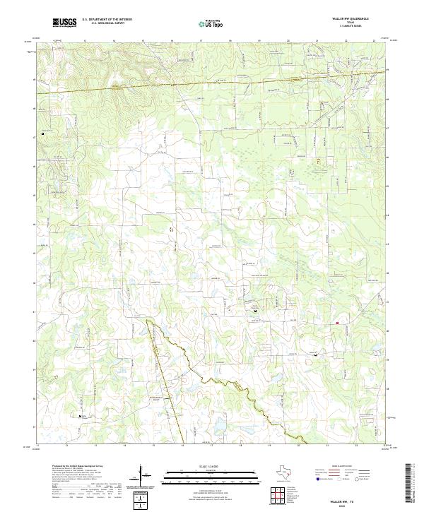
2022 Map of Waller NW
USGS Topo · Published 2022About this map
The rolling prairies and wooded creek valleys of the Grimes Co Waller Co border define this corner of Southeast Texas. The landscape is deeply tied to its rural history, marked by numerous family and community burial grounds such as Rosenau Cem and the Kirby Chapel Cem. A complex drainage network including Spring Cr, Threemile Cr, and Gladish Cr shapes the terrain, leading toward larger water bodies like Lynch Lake and Japhet Lake. The area reflects a mix of traditional agriculture and modern utility, with Moria Meadow Airport serving local aviation needs. This contemporary survey captures the transition from historic farm roads and remote cemeteries to the encroaching developments near the Waller Co Harris Co line.
Find a feature on this map
109 named features on this map. Tap any name to fly to it.
Don’t see what you’re looking for? This feature index may not catch every label — zoom into the map to look around manually.
Map Details
Editions of this 2022 Waller NW Map
This is the sole edition of this map. No revisions or reprints were ever made.
Other maps of this area

1914 · Navasota
USGS Topo · 1:62,500

1916 · Hockley
USGS Topo · 1:24,000

1920 · Hockley
USGS Topo · 1:31,680

1920 · Waller
USGS Topo · 1:31,680

1954 · Beaumont
USGS Topo · 1:250,000

1954 · Austin
USGS Topo · 1:250,000

1956 · Hempstead
USGS Topo · 1:62,500

1957 · Beaumont
USGS Topo · 1:250,000

1958 · Courtney
USGS Topo · 1:24,000

1960 · Waller
USGS Topo · 1:24,000