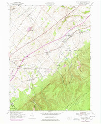
1952 Map of Walnut Bottom
USGS Topo · Published 1978About this map
The rolling agricultural lands of Cumberland Co and Franklin Co transition sharply into the steep, hollow-carved slopes of South Mountain on this mid-century survey. The landscape is defined by a dense network of local education and faith, featuring numerous country schools like the Cherry Grove School and Fairview School, alongside landmarks such as South Mountain Chapel. The village of Walnut Bottom serves as a central hub along the Walnut Bottom Road, while the rural character is reinforced by scattered settlements like Lees Cross Roads and Cleversburg.
Find a feature on this map
59 named features on this map. Tap any name to fly to it.
Don’t see what you’re looking for? This feature index may not catch every label — zoom into the map to look around manually.
Map Details
Editions of this 1952 Walnut Bottom Map
4 editions found
Other maps of this area

1902 · Chambersburg
USGS Topo · 1:62,500

1909 · Fairfield
USGS Topo · 1:62,500

1919 · Newville
USGS Topo · 1:62,500

1923 · Shippensburg
USGS Topo · 1:62,500

1942 · Hagerstown
USGS Topo · 1:125,000

1942 · Gettysburg
USGS Topo · 1:125,000

1943 · Hagerstown
USGS Topo · 1:125,000

1943 · Chambersburg
USGS Topo · 1:62,500

1943 · Shippensburg
USGS Topo · 1:62,500

1944 · Scotland
USGS Topo · 1:31,680
Featured Places
- Shippensburg, PA
- Southampton Township, PA
- North Newton Township, PA
- West Pennsboro Township, PA
- Southampton Township, PA