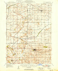
1949 Map of Walnut
USGS Topo · Published 1949About this map
The agricultural landscape of Whiteside, Lee, and Bureau Counties is documented here during the late 1940s, revealing a dense network of rural infrastructure organized around the Green River. The drainage pattern is heavily modified by systems such as the levee-lined main river and various feeders like Five Mile Branch, supporting the intensive farming of the region. Transportation is anchored by the Chicago and North Western and the Chicago Burlington and Quincy railroads, which connect grain-handling settlements like Harmon, Deer Grove, and Normandy.
Find a feature on this map
49 named features on this map. Tap any name to fly to it.
Don’t see what you’re looking for? This feature index may not catch every label — zoom into the map to look around manually.
Map Details
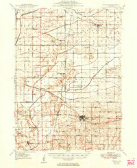
Editions of this 1949 Walnut Map
3 editions found

Other maps of this area

1893 · Hennepin
USGS Topo · 1:62,500

1909 · Hennepin
USGS Topo · 1:62,500

1911 · Hennepin
USGS Topo · 1:62,500

1918 · Dixon
USGS Topo · 1:62,500

1921 · Buda
USGS Topo · 1:62,500

1923 · Buda
USGS Topo · 1:62,500

1929 · Annawan
USGS Topo · 1:62,500

1930 · Woodsung
USGS Topo · 1:48,000

1932 · Prophetstown
USGS Topo · 1:48,000

1932 · Annawan
USGS Topo · 1:62,500