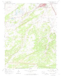
1963 Map of Walsenburg South
USGS Topo · Published 1974About this map
Walsenburg anchors the northern edge of this 1963 survey, a critical transition point where the high plains meet the foothills of the Rockies. The landscape is heavily defined by a coal-mining economy, evidenced by numerous named operations such as the Mutual Mine, Solar Mine, and the Ravenwood Mine. These industrial sites are concentrated along the Denver and Rio Grande Western and Southern railroads, illustrating the vital link between extraction and rail transport during this era.
Find a feature on this map
40 named features on this map. Tap any name to fly to it.
Don’t see what you’re looking for? This feature index may not catch every label — zoom into the map to look around manually.
Map Details
Editions of this 1963 Walsenburg South Map
4 editions found
Other maps of this area

1891 · Walsenburg
USGS Topo · 1:125,000

1891 · Spanish Peaks
USGS Topo · 1:125,000

1893 · Spanish Peaks
USGS Topo · 1:125,000

1894 · Walsenburg
USGS Topo · 1:125,000

1895 · Spanish Peaks
USGS Topo · 1:125,000

1897 · Walsenburg
USGS Topo · 1:125,000

1897 · Spanish Peaks
USGS Topo · 1:125,000

1900 · Spanish Peaks
USGS Topo · 1:125,000

1900 · Walsenburg
USGS Topo · 1:125,000

1954 · Trinidad
USGS Topo · 1:250,000