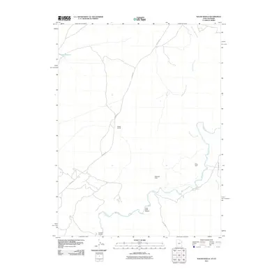
2011 Map of Walsh Knolls
USGS Topo · Published 2011About this map
The White River winds through this high desert terrain in Uintah County, Utah, defining a landscape marked by deep canyons and remote industrial outposts. Along the river’s southern banks, Little Dicks Bottom sits below the confluence with Cottonwood Creek, reflecting the traditional naming conventions of early settlers and ranchers in the region. The map reveals the logistical network of the early 21st century, where Stanton Rd and County Hwy 2 provide access to rugged landforms like Walsh Knolls and Cowboy Canyon. Economic activity is represented by the Iron Bridge Mine, situated near the river, while the presence of the Hacking Reservoir to the northwest indicates the critical role of water management in this arid environment. Significant drainage features like Gilsonite Draw further characterize the area's geology, hinting at the hydrocarbon and mineral deposits that have long drawn industry to this part of the Uinta Basin.
Find a feature on this map
13 named features on this map. Tap any name to fly to it.
Don’t see what you’re looking for? This feature index may not catch every label — zoom into the map to look around manually.
Map Details
Editions of this 2011 Walsh Knolls Map
This is the sole edition of this map. No revisions or reprints were ever made.
Other maps of this area

1885 · East Tavaputs
USGS Topo · 1:250,000

1885 · Ashley
USGS Topo · 1:250,000

1907 · Rangely
USGS Topo · 1:125,000

1907 · Jensen
USGS Topo · 1:125,000

1910 · Jensen
USGS Topo · 1:125,000

1910 · Rangely
USGS Topo · 1:125,000

1954 · Vernal
USGS Topo · 1:250,000

1956 · Grand Junction
USGS Topo · 1:250,000

1958 · Vernal
USGS Topo · 1:250,000

1959 · Grand Junction
USGS Topo · 1:250,000