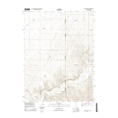
2014 Map of Walsh Knolls
USGS Topo · Published 2014About this map
The White River winds through this arid section of the High Uintahs along the Utah-Colorado border, creating a distinct riparian corridor against the surrounding high desert. The landscape is defined by deep incisions like Cowboy Canyon and Gilsonite Draw, the latter reflecting the region's unique hydrocarbon mining history. Transportation in this area relies on rugged routes such as Stanton Rd and E Eureka Vein Rd, which provide access to high-elevation features like the Walsh Knolls and the Hacking Reservoir to the northwest. In the southern reach of the survey, the terrain levels out significantly at Little Dicks Bottom, a flat alongside the river. This 2014 U.S. Geological Survey provides a detailed look at the complex drainage systems where Dripping Rock Cr and Cottonwood Cr meet the river, marking a remote boundary between Uintah and Rio Blanco counties.
Find a feature on this map
23 named features on this map. Tap any name to fly to it.
Don’t see what you’re looking for? This feature index may not catch every label — zoom into the map to look around manually.
Map Details
Editions of this 2014 Walsh Knolls Map
This is the sole edition of this map. No revisions or reprints were ever made.
Other maps of this area

1885 · East Tavaputs
USGS Topo · 1:250,000

1885 · Ashley
USGS Topo · 1:250,000

1907 · Rangely
USGS Topo · 1:125,000

1907 · Jensen
USGS Topo · 1:125,000

1910 · Jensen
USGS Topo · 1:125,000

1910 · Rangely
USGS Topo · 1:125,000

1954 · Vernal
USGS Topo · 1:250,000

1956 · Grand Junction
USGS Topo · 1:250,000

1958 · Vernal
USGS Topo · 1:250,000

1959 · Grand Junction
USGS Topo · 1:250,000