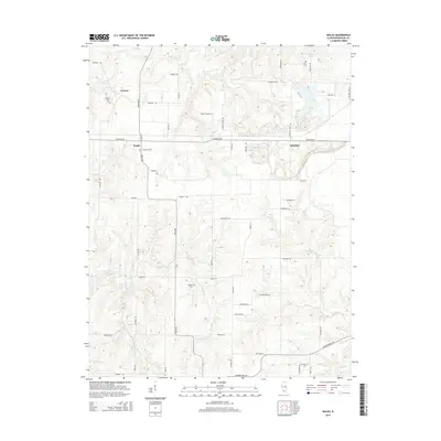
2015 Map of Walsh
USGS Topo · Published 2015About this map
The agricultural landscape of Randolph County is defined by a dense network of family-named roads and rural hamlets in this 2015 study. The settlement of Walsh serves as a central point, with Schuline to the east and Preston to the northwest, all connected by the primary thoroughfare of Schuline Rd. This area is characterized by its numerous small burial grounds, including Preston Cem, Saint Pius Cem, and Lively Cem, which offer significant data points for genealogical research in this part of Illinois. The terrain is drained by several meandering waterways such as Little Plum Cr and Ninemile Cr, which create the gentle relief seen between the gridded farm plots. Larger water features like Langford Pond and the branching reaches of Welge Cr punctuate the southern and eastern portions of the quadrangle.
Find a feature on this map
62 named features on this map. Tap any name to fly to it.
Don’t see what you’re looking for? This feature index may not catch every label — zoom into the map to look around manually.
Map Details
Editions of this 2015 Walsh Map
This is the sole edition of this map. No revisions or reprints were ever made.
Other maps of this area

1912 · Baldwin
USGS Topo · 1:62,500

1914 · Baldwin
USGS Topo · 1:62,500

1914 · Coulterville
USGS Topo · 1:62,500

1915 · Chester
USGS Topo · 1:62,500

1916 · Campbell Hill
USGS Topo · 1:62,500

1917 · Coulterville
USGS Topo · 1:62,500

1918 · Campbell Hill
USGS Topo · 1:62,500

1942 · Baldwin
USGS Topo · 1:62,500

1947 · Chester
USGS Topo · 1:62,500

1949 · Paducah
USGS Topo · 1:250,000