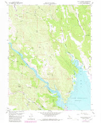
1959 Map of Walter Springs
USGS Topo · Published 1980About this map
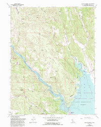
Walter Springs stands at the heart of this Napa County landscape, situated where the terrain transitions from the heights of Turner Mtn and Adams Ridge down toward the evolving waters of Lake Berryessa. The map reflects a period of significant hydrological change, as the State of California Department of Water Resources and the U.S. Bureau of Reclamation documented underwater contours and recreation boundaries following the damming of Putah Creek. This survey captures the intersection of old mountain industry and new recreational development, showing legacy sites like the Blue Monday Mine and Buckhorn Mine alongside a designated Recreation Area and Trailer Park. Rugged canyons such as Pope Canyon and Green Canyon segment the terrain, while interior valleys like Cedar Valley and Gibson Flat provide pockets of level ground amidst the ridges. Local transport is defined by rugged routes, including Dollarhide Road and various Jeep Trails that navigate the slopes of Barton Hill.
Find a feature on this map
31 named features on this map. Tap any name to fly to it.
Don’t see what you’re looking for? This feature index may not catch every label — zoom into the map to look around manually.
Map Details
Editions of this 1959 Walter Springs Map
5 editions found
Other maps of this area

1924 · Capay
USGS Topo · 1:62,500

1942 · St. Helena
USGS Topo · 1:62,500

1943 · Morgan Valley
USGS Topo · 1:62,500

1943 · Capay
USGS Topo · 1:62,500

1944 · Morgan Valley
USGS Topo · 1:62,500

1945 · Capay
USGS Topo · 1:62,500

1945 · Rumsey
USGS Topo · 1:62,500

1945 · St. Helena
USGS Topo · 1:62,500

1947 · Santa Rosa
USGS Topo · 1:250,000

1949 · Santa Rosa
USGS Topo · 1:250,000