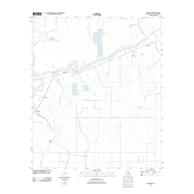
2012 Map of Walters
USGS Topo · Published 2012About this map
Little River defines the central topography of this Catahoula Parish landscape, winding past the small settlements of Archie and Utility. This 2012 survey illustrates a region where water and industry are deeply intertwined, characterized by a complex network of bayous and brakes that drain into the French Fork Little River. The presence of the Utility Oil Field and the Boltners Brake Oil Field suggests a local economy still driven by mineral extraction, even as the rural character is maintained by family-named landmarks like Young Cem and Old Mount Olive Cem. The terrain south of Walters is particularly low-lying, dominated by seasonal water features such as Hibbs Bayou, Elm Slough, and the expansive Open Brake, which shape the patterns of local roads and land use in this part of Louisiana.
Find a feature on this map
41 named features on this map. Tap any name to fly to it.
Don’t see what you’re looking for? This feature index may not catch every label — zoom into the map to look around manually.
Map Details
Editions of this 2012 Walters Map
This is the sole edition of this map. No revisions or reprints were ever made.
Other maps of this area

1935 · Tooleys
USGS Topo · 1:62,500

1941 · Manifest
USGS Topo · 1:62,500

1941 · Jena
USGS Topo · 1:62,500

1941 · Buckeye
USGS Topo · 1:62,500

1941 · Tooleys
USGS Topo · 1:62,500

1953 · Alexandria
USGS Topo · 1:250,000

1953 · Natchez
USGS Topo · 1:250,000

1955 · Alexandria
USGS Topo · 1:250,000

1956 · Natchez
USGS Topo · 1:250,000

1958 · Jena
USGS Topo · 1:62,500