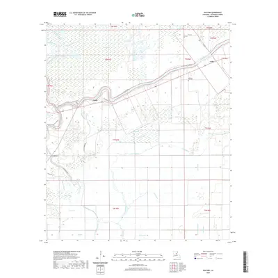
2020 Map of Walters
USGS Topo · Published 2020About this map
Little River winds through the heart of this Catahoula Parish landscape, defining the local geography as it flows past the small settlements of Archie and Walters. The area is characterized by an intricate network of wetlands and seasonal water bodies, including Mayo Brake, Boatner Brake, and the expansive Honey Brake Bayou. These "brakes" and sloughs illustrate the low-lying, alluvial nature of the region, where water management and natural drainage patterns dictate the placement of roads and homesteads. Local family history is preserved at sites like Old Mount Olive Cem and Young Cem, located near Young RD. The map documents a rural environment where life follows the path of the river and the seasonal ebb of the bayous, connected by routes such as Little River RD and Big Bayou Loop.
Find a feature on this map
41 named features on this map. Tap any name to fly to it.
Don’t see what you’re looking for? This feature index may not catch every label — zoom into the map to look around manually.
Map Details
Editions of this 2020 Walters Map
This is the sole edition of this map. No revisions or reprints were ever made.
Other maps of this area

1935 · Tooleys
USGS Topo · 1:62,500

1941 · Manifest
USGS Topo · 1:62,500

1941 · Jena
USGS Topo · 1:62,500

1941 · Buckeye
USGS Topo · 1:62,500

1941 · Tooleys
USGS Topo · 1:62,500

1953 · Alexandria
USGS Topo · 1:250,000

1953 · Natchez
USGS Topo · 1:250,000

1955 · Alexandria
USGS Topo · 1:250,000

1956 · Natchez
USGS Topo · 1:250,000

1958 · Jena
USGS Topo · 1:62,500